Configuring the navigation settings
You can configure the navigation settings for navigation operations, screen display, voice guidance, etc. You can also export or import the location data.
- For details on how to use navigation functions, see the "Navigation" chapter. ▶ See "Navigation."
- On the All Menus screen, press Setup ▶ Navigation.
The navigation settings screen appears.
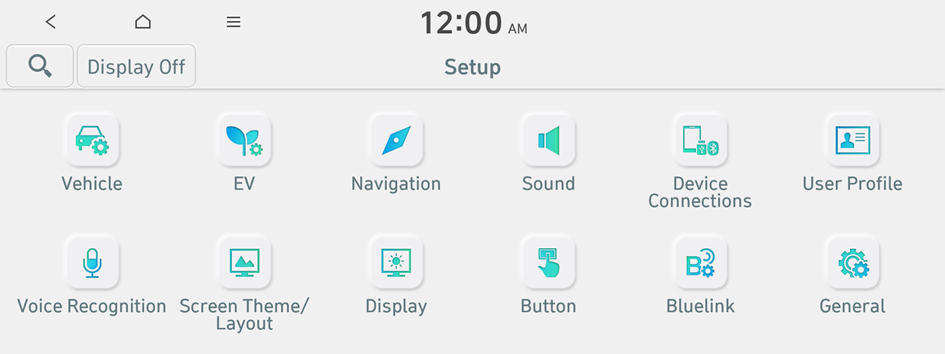
Type 1
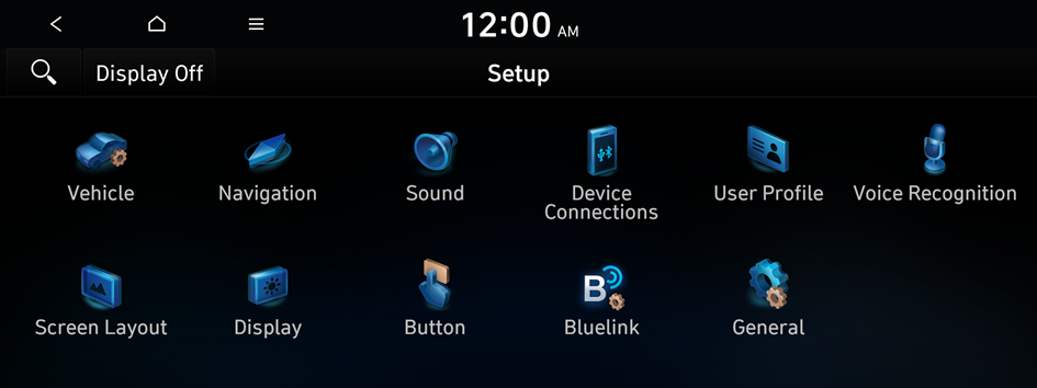
Type 2
- The screen may differ depending on the vehicle model and specifications.
- If the vehicle is type 1, it is possible to change the graphic theme to white or black. ▶ See "Graphic Themes (if equipped)."
- Configure the settings required:
- Press
 ▶ Search for Settings or press
  and enter a keyword to search for a setting item.
Display
You can specify the information to display on the navigation map screen.
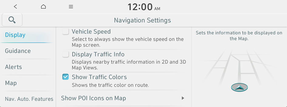
Vehicle Speed
Displays the vehicle speed on the map.
Display Traffic Info
Displays nearby traffic information on the map.
Show Traffic Colors
Change the route guide line color depending on the traffic conditions. To display the route guide line with a fixed color, uncheck Show Traffic Colors.
Show POI Icons on Map
You can specify the icon type to display nearby places on the map.
- Select Auto Display when Charging is Needed to automatically display information on EV (Electric Vehicle) charging stations when charging is needed.
- EV Charging Stations on the map may differ from actual ones.
Guidance
You can configure the navigation guidance settings.
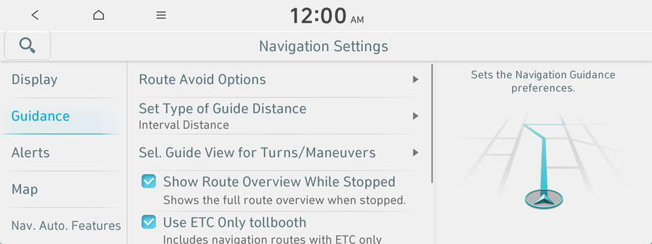
Route Avoid Options
You can resume routing after excluding the specified roads.
Set Type of Guide Distance
You can configure settings for displaying the distance to the destination during guidance.
- • Interval Distance: Displays the distance as the one between different zones.
- • Cumulative Distance: Displays the distance as the one between the current position and target position.
Sel. Guide View for Turns/Maneuvers
You can specify the information to display on the navigation map screen while driving.
- • Detailed Guidance View: You can set to display detailed information on the Map screen, such as moving directions and lane change.
Show Route Overview While Stopped
You can set to display the route overview from the start point to the destination when the vehicle is stationary.
Use ETC Only tollbooth
Include navigation route with Smart IC (ETC-only interchange).
End Navigation Voice Guidance Near Destination
If the set destination is a registered location, voice guidance is turned off when the vehicle gets closer to the destination.
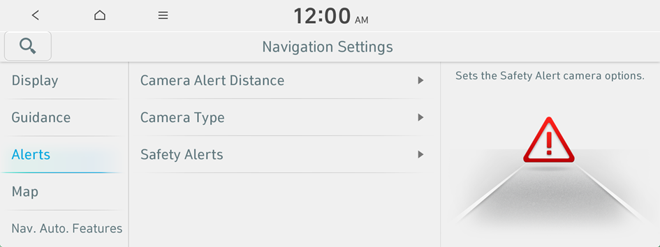
Alerts
You can set to activate drive assist features when needed for safety.

Warning
Be sure to check the road conditions while driving, because the camera information may get changed occasionally after a map update to the latest version. Relying solely on the driving assist system may cause violation of traffic rules and regulations, resulting in an accident.
Camera Alert Distance
You can set when to receive alerts against and voice descriptions about traffic enforcement cameras.
- • Camera Alert Distance Depending on the Speed Limit: The time when to get alerts for traffic enforcement cameras is automatically set depending on the driving speed. When the Camera Alert Distance Depending on the Speed Limit function is off, the time when to get guidance on traffic enforcement cameras on Local Roads and Expressway can be selected.
Camera Type
Sets the properties of the alerts against traffic enforcement cameras.
Safety Alerts
Sets the situations for which Safety alerts will be provided.
Map
You can specify the items to display on the map.

Map Mode
You can specify the items to display on the map.
- • Map View: Set the navigation map display mode. To fix the top of the map screen to north, select North Up 2D. To automatically rotate the map screen based on the driving direction, select Heading Up 2D. If you select Heading Up 3D, the map screen is displayed in 3D mode and automatically rotates based on the driving direction.
- • 3D Buildings: Displays major buildings on the map in three dimensions.
- • Auto-scale: Automatically changes the scale of the map.
Map Color (if equipped)
Sets the Map color.
Map Font Size
You can set the size of the screen font on the navigation map.
Vehicle Symbol Color
You can specify the icon type to display your current location on the map.
Set Map Auto-scale
You can set the scale, which is automatically adjusted based on the vehicle speed.
Nav. Auto. Features
You can configure navigation options, e.g., exporting or importing places from and to Address Book.
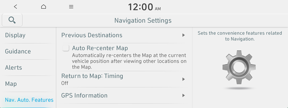
Previous Destinations
You can set to automatically save the previous destination and display the previous destinations when the navigation system starts.
- • Save Previous Destinations: The previous destination is automatically saved.
- • Display Previous Destinations when entering the Map screen: When the navigation system starts, the list of recent destinations appear on a pop-up window.
Auto Re-center Map
You can set the system to automatically display the current position when the specified period of time elapses after changing to another position on the map.
Return to Map: Timing
You can set the system to automatically display the map screen after a specified period of time when switched to the Radio/Media mode screen while using the navigation.
- This function works while driving once a destination has been set.
- This feature is not available on the phone projection screen.
GPS Information
You can see the GPS satellite status and coordinates of the current position.
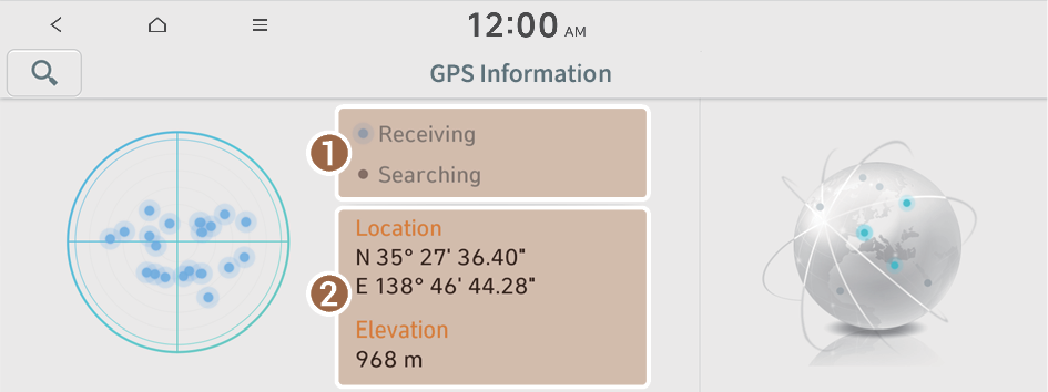
The following information appears:
- Can see the reception status of the satellite signals.
- • Receiving: Satellite signals are being received and the current position is recognized.
- • Searching: The system is scanning the satellite signals.
- Can see the current location.


