Configuring the navigation settings
You can configure the navigation operations, screen display, voice guidance, and other settings.
- Available settings may differ depending on the vehicle model and specifications.
- For details on how to use navigation functions, refer to the following: ▶ see "Map."
- On the Home screen, press Settings ▶ Navigation.
The navigation settings screen appears.
- Configure the settings as required.
- Press
 on the screen or press the button on the control panel, enter a search term, and then select the item to run.
Display
Select, which information to display.
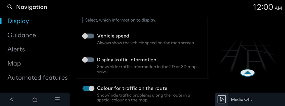
Vehicle speed
Always show the vehicle speed on the map screen.
Display traffic information (if equipped)
Show/hide traffic information in the 2D or 3D map view.
Colour for traffic on the route
Show/hide traffic problems along the route in a special colour on the map.
Show POI icons
Display of POI icons on the map screen.
- Press
 on the right side of Gas/LPG Station to select display options for fuel prices.
- Gas and LPG stations on the Map screen will also show their fuel prices if they are lower than the set price.
- Select Display fuel price info on map to view recommended fuel prices based on the prices offered in the area.
- Fuel prices on the map may differ from actual prices.
- Select Auto display when charging is needed is set for display of EV charging stations to show nearby charging stations on the map only when the vehicle needs charging (EV only).
Fuel price info (if equipped)
Option to display fuel price information
- Select Display fuel price info on map to view recommended fuel prices based on the prices offered in the area.
- Fuel prices on the map may differ from actual prices.
Guidance
Guide information settings
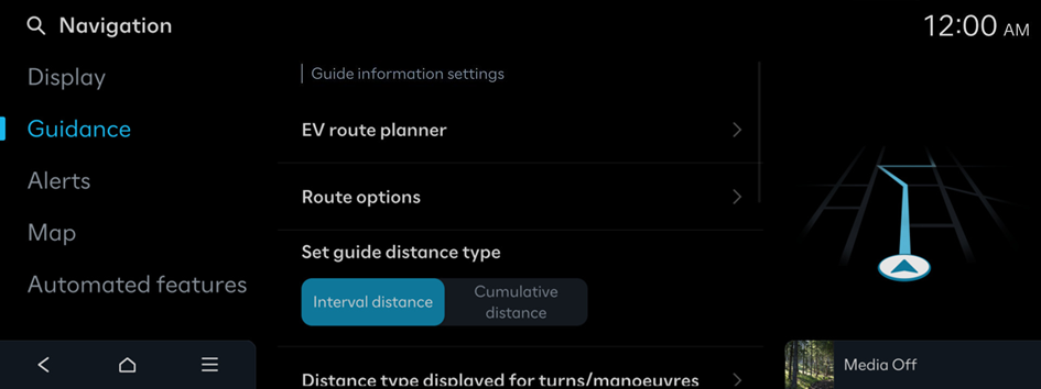
EV route planner (EV only)
The acceptable minimum battery charge while following a route
Route options or Avoidance options
Displays on the entire route screen in the order of the set route search options.
Set guide distance type
Set how to display the distance to the destination during route guidance.
- • Interval distance: Displays the distance to the next waypoint and the distance between the last waypoint and the destination.
- • Cumulative distance: Displays the cumulative distance from the current point to the destination.
Distance type displayed for turns/manoeuvres
Activation of the detailed guidance view
- • Show route details: An enlarged and detailed view at each turn and manoeuvre.
- • Augmented reality view of guidance location: Displays augmented reality view at guidance location (if equipped).
Border crossing information
Settings for the border crossing info
- • Border crossing information: Enable/disable country border crossing information.
- • Country information: Display of country information based on the current location.
Alternative route information
Provision of additional routes on the map screen. Toll-free route options are excluded.
Show route overview while stopped
Map is switched to route overview when the vehicle stops.
Mute voice guidance nearby destination
Voice guidance will end near the destination registered in favourites.
Alerts
Settings for the alert
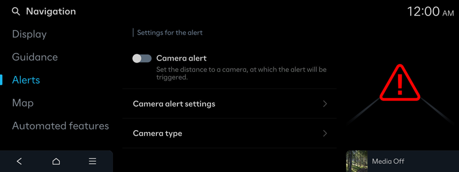
Camera alert
Set the distance to a camera, at which the alert will be triggered.
- The speed limits displayed on the navigation system may differ from the actual road conditions.
Camera alert settings
Set the distance to a camera, at which the alert will be triggered.
- • Alert distance depending on the speed limit: Automatically change camera alert distance according to the speed limit. When the Alert distance depending on the speed limit function is off, the time when to get guidance on traffic enforcement cameras on Alert distance (general) and Alert distance (motorway) can be selected.
Camera type
Select camera types for alerts
Map
The properties of the map display
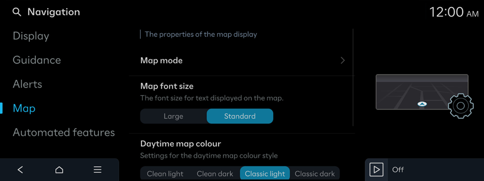
Map mode
Settings for the map display mode
- • Map view: Settings for the map view
- 2D North up: Displays the map with the north fixed at the top.
- 2D heading up: Rotates the map depending on the driving direction.
- 3D heading up: Rotates the map depending on the driving direction for 3D view.
- AR: Displays the travel direction on the actual road image via the front-view camera (if equipped).
- • 3D buildings: Option to display 3D buildings in the 3D map view
- • Auto zoom: Automatic adjustment of the map scale
Map font size
The font size for text displayed on the map
Daytime map colour
Settings for the daytime map colour style
Auto zoom settings
The auto-scale range for automatically scaling the map based on the vehicle speed
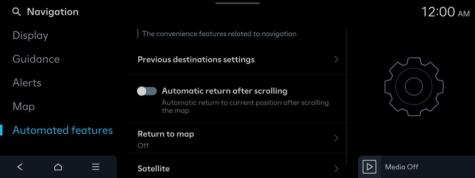
Automated features
The convenience features related to navigation
Previous destinations
Enable/disable saving previous destinations.
- • Save previous destinations: The set destination is saved in the previous destinations.
- • Display previous destinations when entering the map screen: When entering the map screen for the first time, previous destinations are displayed.
Automatic return after scrolling
Automatic return to current position after scrolling the map
Return to map
After the set time, the system switches from Radio/Media to the map screen, if a route is active. Not for phone projection.
- This function works while driving when a destination has been set.
- This function is not available on the phone projection screen.
Satellite
Satellite status information


